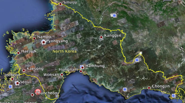
 When reading the Wall Street Journal this morning over a glass of orange juice my Dad pointed out to me this really fascinating article about how former intelligence people for the U.S. military and people who are just interested in the secret society that is North Korea were mapping out all its secrets via Google Earth.
In the article “Gulags, Nukes and a Water Slide: Citizens Spies Lift North Korea’s Veil“ By: Evan Ramstad, it mentions how people have been using Google Earth to map out and discover the secrets of North Korea. Ramstad mentions a doctoral candidate at George Mason University, Curtis Melvin, who reveals that he used images of Kim Jong Il’s visit to a hydroelectric plant, and the terrain around him to find the exact location of where the plant was in North Korea. Many other people have managed to uncover possible mass grave sites of the tragic famine of 1996-98, as well as military bases, developing local markets, and power plants. But what also became uncovered, was the infrastructure that showed the massive distance of luxuries between Kim Jong Il and his people. “Once you star mapping the power plants and substations and wires, you can connect the infrastructure with the elite compounds, and then you see towns that have no power supply at all.” said Mr. Melvin from the article.
The article also mentions how Senator Sam Brownback of Kansas used the Google Maps discoveries as evidence during a floor presentation where he said, “Google has made a witness of all of us… We can no longer deny these things exist.”
This brings Google Earth and the discoveries by these normal citizens to a much higher level, and deservedly so. Google Earth has allowed for the public to effectively pursue intelligence gathering of North Korea, and not just exploring possible vacation destinations. No doubt this must frustrate the government of that secrecy-focused government.
Google Earth has been proven to be a great tool. Even in my life. In my case, I have used Google Earth to scout out possible trails and attack vectors for paint ball games with my friends.
Note from the Editor:
This story really points out the power of the Internet to engage people with seemingly niche interests to achieve goals that before the Internet were only possible in the corridors of government bureaucracies. Sort of like this blog and millions like them have changed professional journalism, politics and dozens of other industries.


